Average period
Wednesday, 1 March 2023

Average period
Wednesday, 1 March 2023
There's nowhere to recommend for the coming days, with a couple of options early next week.
There's nowhere to recommend for the coming days, with a couple of options early next week.
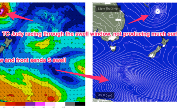
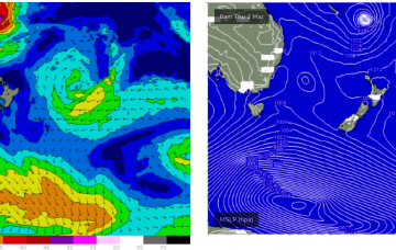
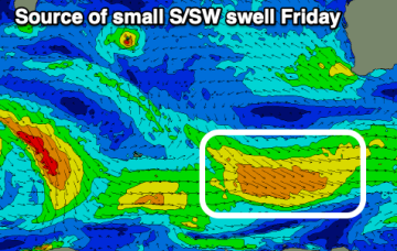
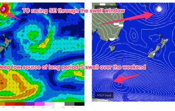
Lots of action on the charts but not much of it will translate to meaningful surf for the Eastern Seaboard. The tropics remains active with a monsoon trough and convective activity strewn across the Top End, while the edge of the trough in the South Pacific has spawned TC Judy, with another system behind it. Both of those systems are now modelled to track quickly SE through the swell window with no major swells generated.
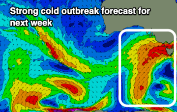
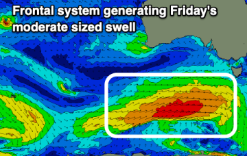
There'll be plenty of swell to end the week, but winds are mostly dicey, better on the weekend. Next week will be cold, windy and sizey.
Windows of clean conditions and options across both regions this period before next week becomes cold, windy and sizey.
The troughy pattern will see a weakening trade flow in the Coral Sea this week and while all eyes are on the tropics it’s looking like a continuing tease with an expected tropical depression or TC moving quite quickly SE through the swell window with limited surf potential.
It's a tricky period but there'll be plenty of windows for a clean, fun wave.
The troughy pattern will see rapid fire wind changes across Eastern Tasmania this week.
The fun waves from the last few days will fade, with nothing too major to back it up.
The troughy pattern will see rapid fire wind changes across temperate NSW this week and while all eyes are on the tropics it’s looking like a continuing tease with an expected tropical depression or TC moving quite quickly SE through the swell window with limited surf potential.
The South Coast will be poor all week, while the swells won't have enough west in the to provide any real size on the Mid Coast.