Fun mid week swells, best suited to Northern NSW
Tuesday, 26 December 2017

Fun mid week swells, best suited to Northern NSW
Tuesday, 26 December 2017
We’ve got a small increase in swell due for Northern NSW over the next few days.
We’ve got a small increase in swell due for Northern NSW over the next few days.
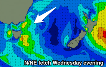
Small N/NE windswell building late tomorrow, peaking Thursday as winds slowly swing offshore.
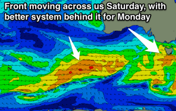
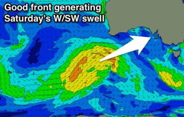
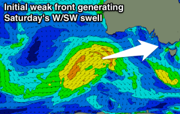
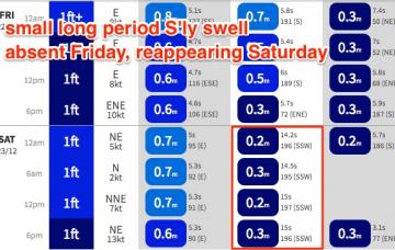
Easing W/SW swell tomorrow with an early N'ly wind, tiny to flat the rest of the week. New swell building Saturday, better Monday.
Onshore winds with small weak levels of windswell, cleaner early each morning from Thursday. Fun clean swell Saturday morning.
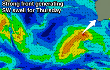
Good W/SW swell for Wednesday though with average winds, reinforcing swell Thursday as winds slowly improve, cleanest Saturday across the South West.
Peaky easing S/SW swell tomorrow, cleaner Wednesday though small to tiny. New W/SW swells from Friday, best over the weekend but with less than ideal winds.
Workable waves in protected spots tomorrow morning east of Melbourne, much better Wednesday but smaller. Tiny W/SW swell for Friday with onshore winds, better over the weekend.
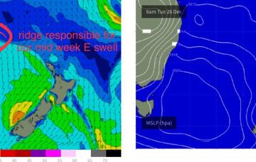
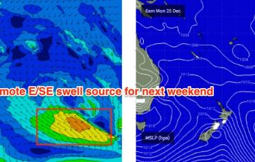
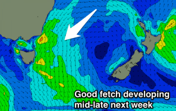
Fortunately, a ridge will build through the central Tasman Sea around the same time and this will build SE swells across the region through Tuesday, Wednesday and Thursday.
I’m glad that I uploaded a screen shot of the model guidance in Wednesday's notes (with the caption ‘models aren’t picking up the new S’ly swell very well’) for Friday, because they’ve actually wiped it from this morning’s model run - for today, that is.
No surfing options until mid-late next week when we see some fun N/NE windswell. Try the South Arm.