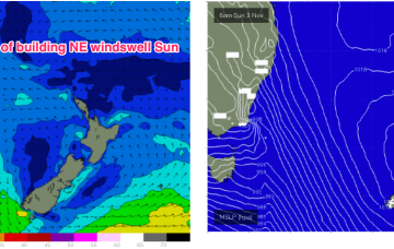
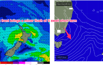
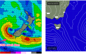
A few windows in a fairly lacklustre forecast
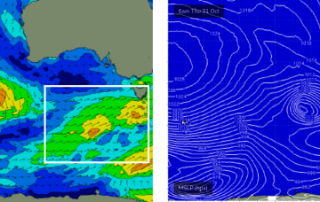
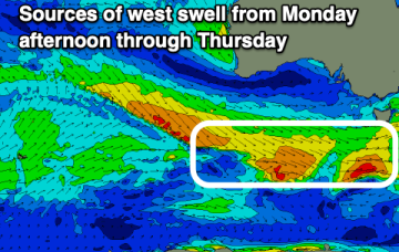
Into the weekend and we won’t see too much in the way of swell energy with the Indian Ocean in a quiet phase through the main WA swell window.
A series of modest fronts skirting the southern states probably won’t affect our local winds too much in the short term, however we will see plenty of surf.
A series of modest fronts skirting the southern states will maintain a westerly airstream for the next few days.
The result is a weak, troughy pattern in the Tasman and inland and weak winds in the Coral Sea- unstable but not very surfy. With nothing of any significance in the outlook we’ll see tiny/flat surf once this small signal fades away tomorrow.
Under current modelling it looks one of the more significant NE fetches for the Spring, extending north into sub-tropical latitudes right down to Tasmania.
High pressure drifts into the Bight but weakens as the week progresses with a weak high cell budding off and moving NE into the Tasman. The result is a weak, troughy pattern in the Tasman and inland- unstable but not very surfy.
There’s a very minor fetch Sun/Mon next week that may generate some just rideable surf on Sun/Mon but keep expectations low, it’ll be tiny and weak if it’s rideable, so bring a log.
A complex but disjointed low has formed in the Tasman with diffuse centres off the North Coast and Tasmania/Gippsland coast. We’ll see S swells generated by the proximate fetches from this system easing into the weekend.
The coming period is small but there'll be clean conditions for a surf most days.