Action shifts from the gulf to the South Coast
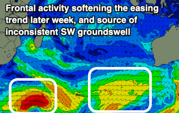
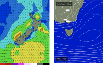
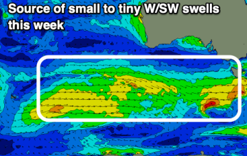
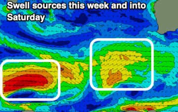
Make the most of the waves in the gulf before the swell fades and winds go north Friday. There'll be windows down South to follow.
A more consistent, though weaker west swell is due over the coming days with favourable winds. Stormy conditions from the SE will develop from Sunday.
The headline feature is a potential major tropical cyclone drifting into the Coral Sea with a poleward (southwards) track late this week, over the weekend and into next week. It’s still early days but under certain modelled outcomes we could see a coast hugging system bringing large swells to the CQ coast.
No major swells expected this week. The headline feature is a potential major tropical cyclone drifting into the Coral Sea with a poleward (southwards) track late this week, over the weekend and into next week. It’s unlikely for the system to reach far enough south to generate surf for NETas but there are some modelled outcomes suggesting it might.
Fading S swell tomorrow with small to tiny westerly pulses to follow.
Cleaner conditions are due over the coming days with a drop in swell, windier and less favourable later week.
Weak high pressure in the Tasman and a trough is creating a “doldrums” type pattern of slack pressure gradients and small swells this week, with a few wind changes to negotiate. No major swells expected this week. The headline feature is a potential major tropical cyclone drifting into the Coral Sea with a poleward (southwards) track late this week, over the weekend and into next week.
The coming week should see fun levels of W/SW swell with workable winds for both regions.
Weak high pressure in the Tasman and a trough is creating a “doldrums” type pattern of slack pressure gradients and small swells this week, with a few wind changes to negotiate. No major swells expected this week. The headline feature is a potential major tropical cyclone drifting into the Coral Sea with a poleward (southwards) track late this week, over the weekend and into next week.