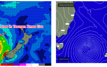
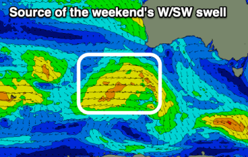
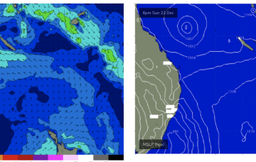
Poor weekend, improving slowly next week
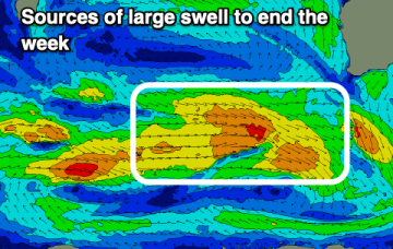
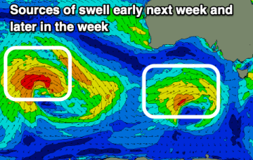
The coming period looks mostly average for the South Coast apart from a couple of windows next week with small to tiny swells on the Mid Coast.
Still looking good for Sat. Current ASCAT (satellite windspeed) pass shows a Tasman low with a long fetch of strong S-S/SE winds well positioned in the swell window.
Current ASCAT (satellite windspeed) pass shows a Tasman low with a long fetch of strong S-S/SE winds well positioned in the swell window. Concurrently, weak high pressure is moving NE to be off the sub-tropical coast o/night and into tomorrow morning.
It won't be until Christmas day that we see the winds back off and surf clean up.
Swells of slightly less size due this period.
West swells continue with no major size.
Next week looks a slightly better bet. Looking to the north a weak monsoonal low looks to form off the North QLD Coast and drift into the Coral Sea.
A small spike in short range S swell will be reinforced by better quality SE-E/SE swells later this week.
Conditions won't be as favourable but more large surf is due to end off the week.
We currently have a deepening trough of low pressure developing behind a front which is bringing fresh and gusty S’ly winds up the NSW coastline, extending into the sub-tropics through the day. This trough of low pressure deepens into a surface low in the Tasman and is expected to track in a northerly direction through the short term.