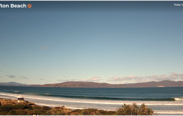
Today's change brings a poor run of winds
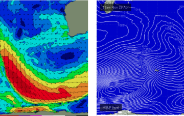
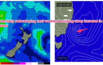
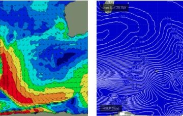
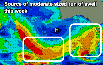
High pressure sitting to our west over the coming week will bring generally poor conditions with moderate sized swell pulses.
Let’s pull things back a notch and be pleasantly surprised if they exceed expectations, eh?
No change to the weekend outlook, with clean conditions both days.
No change to the weekend outlook, with clean conditions both days - light variable winds Saturday tending light N’ly on Sunday, and only weak sea breezes into the afternoons.
No change to the weekend outlook, with clean conditions both days.
Small E/SE swell holds early next week- generated by winds in the Coral Sea and the slot between New Caledonia and the North Island and offering up fun, rideable waves on low tides.
By Tues we’ll see a powerful front sweep past the state with a zonal fetch. We’ll see some small S swell wrap to 2-3ft at S facing beaches Tues.
At issue is a trough in advance of a major high pressure ridge. At a minimum, the trough will charge up a SE surge along the NSW coast with an increase in S/SE-SE swell later Tues and into Wed
Things get interesting/dynamic from Tues. At issue is a trough and potential surface low in advance of a major high pressure ridge.
Great surf is expected throughout the Margaret River region on Thursday and Friday with a new long period groundswell...