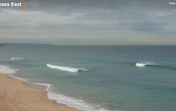
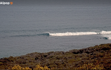
Stacks of inbound swell, but tricky winds 
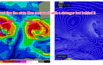
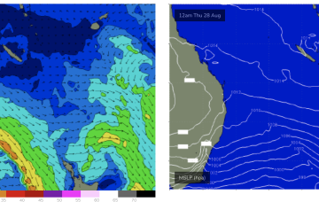
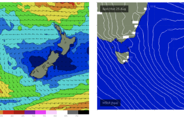
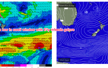
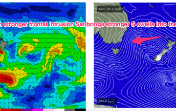
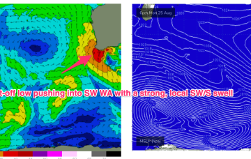
We’re entering a windy wintry pattern for the next week or so, and there’s a bunch of interesting swells on the boil.
A large high (1036hPa) sits well to the west of the state and slowly moves towards the state while exerting a blocking pattern on upstream low pressure systems compared to the near past.
High pressure is moving up over QLD and E’ly winds are deserting the Coral Sea. That will see a period of tiny/flat winter-style surf set in this week and into the weekend.
These low centres are focussing areas of E’ly to NE’ly infeed along the trough line- perfectly aimed at east coast targets all the way down to Tasmania.
These low centres are focussing areas of E’ly infeed along the trough line- perfectly aimed at east coast targets.
A deep Southern Ocean low well to the SW of West Oz today is setting up a better long period groundswell that’ll arrive on Monday morning, and peak late in the day before easing through Tuesday.
Saturday’s looking really fun across both coasts.
The next swell generated by a compact but storm force low tracking from Heard Is towards WA fills in Sun.
Although we’re still some time away from the inbound W’ly swell to reach Cape Sorell, there are some other upstream data points that can assist in the decision making process.