Trickier period but with windows of fun surf
Friday, 21 February 2025
Trickier period but with windows of fun surf
Friday, 21 February 2025
It's not looking epic, but there'll be fun surf days to work with this period.
It's not looking epic, but there'll be fun surf days to work with this period.
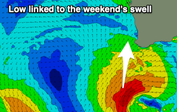
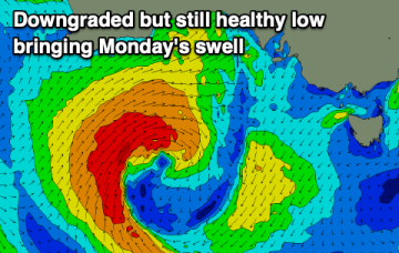
Medium term surf potential rests on these tropical lows, with the supporting tradewind belt supplying plenty of energy in the interim, focussed on the sub-tropics.
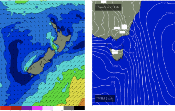
High pressure has moved into the Tasman and sits there over the weekend. It’s quite a strong high (expected to strengthen from 1025 to 1030 hPa) with a typical wind signature for this time of year- mod/fresh SE winds in the sub-tropics, tending to NE winds in temperate NSW and extending down to Tasmania.
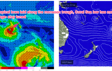
The monsoon trough is still active with a tropical low off the N.QLD coast and lows in the South Pacific through the Island chains. Medium term surf potential rests on these tropical lows, with the supporting tradewind belt supplying plenty of energy in the interim, focussed on the sub-tropics.
The monsoon trough is still active with a tropical low off the N.QLD coast and lows in the South Pacific through the Island chains. Medium term surf potential rests on these tropical lows, with the supporting tradewind belt supplying plenty of energy in the interim, focussed on the sub-tropics short term.
Both coasts look to shine this period with offshore winds tomorrow and a clean westerly swell early next week.
Make the most of tomorrow before conditions deteriorate into Sunday. Early next week will then offer a short window for locations west of Melbourne.
Fun, background swells for the weekend with a stronger pulse through the middle of next week.
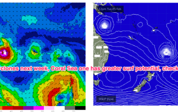
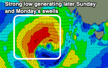
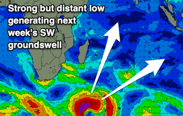
We’ll see a brief fallow period before a SE surge Fri brings a new SE swell with the next round of Tradeswell next week, possibly enhanced by tropical low pressure systems in the South Pacific and Coral Sea.
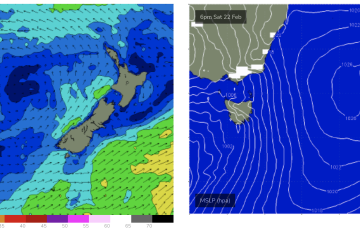
Following that, high pressure moving into the Tasman will supply another round of NE windswell over the weekend.

