Good S'ly swell tomorrow, with a mix of E/NE swell

Eastern Tasmania Surf Forecast by Craig Brokensha (issued Friday 3rd March)
Best Days: Saturday, Sunday morning, Tuesday through Thursday mornings at south magnets
Recap
Clean fun waves out of the east yesterday, easing back a little this morning and best in protected spots with a southerly wind.
A new S'ly groundswell should show by dark across south swell magnets but conditions are poor here.
This weekend and next week (Mar 4 - 10)
Over the weekend some inconsistent background E/NE swell should hold around 2ft on the sets at open beaches, but tomorrow morning, the S'ly groundswell is the one you should target.
South facing beaches should still have 2-3ft sets and be clean with an early NW wind ahead of N/NE sea breezes.
There isn't expected to be any size left at all Sunday.
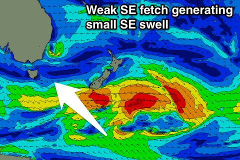 Looking at the latest updates regarding the low forming in the Tasman Sea, and unfortunately the models have most of the activity occurring too far north of our swell window, with maybe some E/SE swell due mid-late week once a SE fetch establishes off New Zealand's South Island.
There should be some small S/SE swell present from later Monday but more so Tuesday through Thursday morning, from a relatively weak but persistent fetch of SE winds around the backside of the low responsible for tomorrow's S'ly swell.
Only 2ft or so of swell is expected with light offshore winds Tuesday and Wednesday mornings.
Longer term we continue to monitor the Tasman Low, and some N'ly windswell late week, but more on this Monday. Have a great weekend!