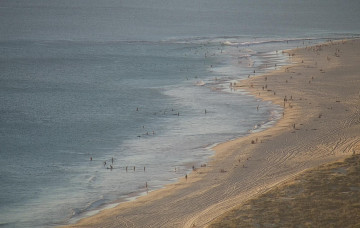
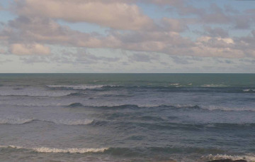
Fun weekend of waves; solid but windy early next week
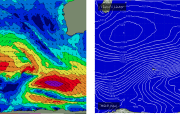
It needs to be reiterated that these kinds of swell patterns are tricky to estimate the precise surf size at specific times of the day...
No new groundswell is due over the weekend so options will be limited to exposed beaches on Saturday.
A strong frontal sequence through the Southern Ocean right now will generate a sequence of new long period swells for Monday and Tuesday.
By Mon morning we should have a complex trough of low pressure NE of K’gari (Fraser Is) with a well developed fetch of strong SE winds feeding into the low and extending well out into the Coral Sea.
Further ahead and things look juicier later next week as a strong cold front sweeps in and conjoins with an area of low pressure exiting the Gippsland coast.
We've got plenty of surf lining up for next week though we have a few days of tricky winds to contend with.
By Mon morning we should have a complex trough of low pressure NE of K’gari (Fraser Is) with a well developed fetch of strong SE winds feeding into the low and extending well out into the Coral Sea.
As the low moves offshore Fri odds are firming we’ll see a major S swell develop as gales develop on the western flank of the low, proximate to the NSW coast.
A low point in swell activity is expected on Thursday morning, before we see the leading edge of a new swell sequence arrive later in the day.
Looks like a few days of craptacular surf across the coast - not enough size for the Mid, and persistent onshores down south as a front crosses through our longitudes. Next week looks much different though.