South East Queensland and Northern New South Wales (issued Friday 11th April)


For those who like to get right inside these tropical systems oz cyclone chasers are a good resource.


All this looking at Sydney...!!! I'm really starting to froth for Sunny coast stand up pits (Noosa), even BOM is calling a steep rise in swell due Tuesday arvo. Ben I know you must be busy as, with this swell event in Sydney, but any chance of a brief update north of the border, it's such a dynamic situation and by tomorrow morning the ex cyclone track should be just about set in stone right?


cheers tobym


don't say much about swell though, but I will say one thing, The reef deserves someone somewhere going on a surf trip, if the holmer-cross boys can charter their own boat to the middle of the Tasman sea, surely someone must want to document it (the reef). It's hardly going to get crowded just because of where it is and it would quite frankly be vindication for any surfer who surfed 'north of Noosa'. C'mon Tom Bonython!


I think it's Tim!!!
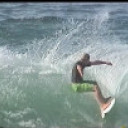

It's very tricky out there, Dromo...... Whole different ballgame to Pedra.....


i have just been informed that there will be no swell at noosa for two years i just did the long range forecast, yes its a pity i know but spread the word no waves at noosa for two years so everyone has to go to burleigh or down that way


thermalben wrote:dromodreamer05 wrote:I'm really starting to froth for Sunny coast stand up pits (Noosa), even BOM is calling a steep rise in swell due Tuesday arvo. Ben I know you must be busy as, with this swell event in Sydney, but any chance of a brief update north of the border, it's such a dynamic situation and by tomorrow morning the ex cyclone track should be just about set in stone right?
Still no change to Friday's forecast. We're not going to see any direct influence from the cyclone per se; by that I mean we're not going to see what everyone is hoping for (that being a solid event from the NE or E).
We'll see an increase in short range S/SE swell Mon/Tues as the former cyclone whisks past the region but this will be no different to common short range S/SE swells generated by strengthening ridges. And it won't be getting into Noosa very well either.
Interesting call....... Cat1 currently taking 100km course over warm water.... keeping cat 1 status....
"predicted" to still be cat1 tomorrow..... So, I think a different scenario is on the cards, ben......... As the blind man says "we'll see"...


dromodreamer05 wrote:don't say much about swell though, but I will say one thing, The reef deserves someone somewhere going on a surf trip, if the holmer-cross boys can charter their own boat to the middle of the Tasman sea, surely someone must want to document it (the reef). It's hardly going to get crowded just because of where it is and it would quite frankly be vindication for any surfer who surfed 'north of Noosa'. C'mon Tom Bonython!
There is plenty of documented trips out "the reef". It is very fickle and open to the elements. A lot of us prefer to keep it a little quiet. One place is becoming quite busy, but it is still unknown to most. Seek and ye shall find.


Two possible scenarios...... both to produce a short range very chunky east swell..... Go with the "models" 1st -1....secondary low off fraser 4am monday will create active sea state - enough juice in that alone to form east swell..... Will reform with Ita tues am..... Some form of east swell late monday thru Tues..
2..... - not on models - outside chance - Water temp at Hay point 26.6c....... If Ita takes a more s.e track over water, could remain cat1 thru to Great Keppel......


EC has Ita remaining Cat 1 a fair way down the coast. But the fetch is very very compact. Be lucky to see anything over a mid range (period) 1-2ft NE at best later Monday and into Tuesday I reckon.
Again, I'm looking further to the horizon later in the week!!!


Growing ene swell midday on tomorrow, will get into noosa, Ben......Tues morn - 7 - 8 second east swell, 4footish', outer point noosa, taper to 2 foot first point..... bad sweep, worse than usual.... very high tide may hide swell early...... Late morning will be better...... Gradual swing in swell to ese by evening.
Late tues/Wed on gold coast will be interesting at points more open to south swell, with 2 different swells in the mix.... ese and sse.....


G'day Dromodreamer05
Mate, rather than wait for someone to " document" these spots you should research the fuck out of that reef, narrow down your best location and the conditions it would require. Line up a few like minds , make an action plan then wait for your opportunity.
May take a while, a bit of coin and there could well be a skunking or three. But if you persevere and score you will feel a stoke like no other in surfing and when your steaming back home with a beer in your hand I can guarantee you will be overwhelmingly happy that Tim Bonython has never shot a single frame of the joint.


well known spot on great barrier reef


Its becoming well known SD. Fortunately the boys didn't name it. It's still a mystery to many, but becoming crowded when it's on. There are plenty of other quality breaks around. There is over 2'000km(?) of outer reef from North of Fraser to PNG. Even a couple of quality breaks near where you grew up.


Nothing much showing yet but some interesting wind strengths developing even a robust NNE fetch developing out around Cato Is.


Question is how long is the fetch out there? Ascat passes keep fecking missing it!!!! Still only sustained wind speeds of around 30knts looking at the BOM observations.
http://www.bom.gov.au/products/IDQ60801/IDQ60801.94394.shtml


fitzroy-21 wrote:Its becoming well known SD. Fortunately the boys didn't name it. It's still a mystery to many, but becoming crowded when it's on. There are plenty of other quality breaks around. There is over 2'000km(?) of outer reef from North of Fraser to PNG. Even a couple of quality breaks near where you grew up.
Fitzy..... You might've missed this thread, surfed alot of those breaks you a talking about -
http://www.swellnet.com/forums/swellnet-forecast-notes/107226
Ben - Gladstone buoy currently has max wave close to 4m, sig at 2m, 8seconds..... from the east with a pinch of north in it.......


thermalben wrote:Current model guidance for 7am this morning. The N'ly fetch around TC Ita is moving too quickly to the SE to generate a meaningful swell. I'd also be a little suss on swell directions at Gladstone due to the attenuating effects of the GBR.
Ben... Hope your aren't hoping for no east swell... ;)
Note map i posted hear, and discussion surrounding it, and comments on previous pages, 25th, 7.40pm, Benski 25th 10.19pm, 29th 9.22am, benksi 29th 11.06pm .
Very similar setup
http://www.swellnet.com/forums/f-stop/101456?page=4


Yeah I missed that one SD. Starting to wonder if we have actually met. I spent a long time Nth of The Bay to the Straits quite often surfing all those outer reefs alone. Only ever took 1 other guy out up there. These days I spend most of my time on the southern end of the chain and only venture up there for the Giant Black's season or relief drives on the commercials if I'm not too busy. Even visit the outlaws when I have to!!


Your nickname isn't "Munya", I hope.... First name Allan...... If it is, you are a madman lol ;) Went out on a surfing trip to the reefs off cairns with a bloke named munya...... Dead set psychopath.... I felt safer in the water than on the boat......


Fair enough ben..... BTW Wont be NE..... Never said that.... Ene swinging to east.... gradual swing to ese be late tues/wed , short range chunky were my words..... Live by the sword, die by the sword is my motto..... Cheers man.....


SD, for the E'ly swell that you're referring too, you're relying on that 2nd low, yeah? Cause the fetch off Ita appears to have feck all east fetch in her. Much better chance of NE swell from Ita's fetch IMO, unless that 2ndary low/fetch ramps up? Wish ASCAT would pick up ITA!!!!


Ene..... Will be intitial 2 foot ne windswell ...not worth noting...... Once Ita passes thru 155', true chunky ene swell will develop You guys better have a quick look at the noosa cam....... As suggested, Noosa is breaking now.... Reported 1 -2 sse swell would not be making noosa break......


Sheepy if this happens you have a job with swellnet.


Sweet. Thanks Ben. Ceratinly a fairly strong N/NE'ly fetch aimed straight at the Sunny Coast. I think we'll see some sly 2fters from the N/NE Tuesday morning, maybe even late this afternoon. Problem is, the Byron Buoy will be the only real one to fully show this, and it may not show up there as the fetch is more aimed at the SC by the looks of it.


So SD, what fetch is this E'ly swell coming from? Ita or the secondary low/fetch further to the SE?
Ascat not showing much to the E/NE of Noosa at the moment, however it could have missed it?


Don, the best thing about having a storm so close is the fact that us weather nerds are up close and personal to a wave producing system.... Alot different to Luci or mike.... Note ben's wind map- a maelstrom..... Note swell directions at tweed, gold coast, North Moreton, Caloundra, Mooloolabah, - east to ease south east.......
http://www.ehp.qld.gov.au/coastal/monitoring/waves/index.php
We also have ne windswell to the north with no buoys to check....
We are so close to the "birth zone" of the swell........ Ne influences, East inluences, se influences......... No fetch so to speak, just a maelstrom of influences that in my opinion will conglomerate into an ene close range "chunky".....


Noosa is breaking according to the cam there. And if First Point is one to two feet then it figures the outer bays etc etc.
It definitely isn't coming from the Tasman low. The Ox and surrounds are a dribbly, sloppy three feet.


SD, one must always take the SE Qld wave buoy directions with a grain of salt. They only show generic trend of swell direction rather than actual swell direction....with the exception of the North Straddie (Brisbane) wave buoy. And it's still showing true S'ly swell, much aligned with Byron buoy. The shallow water (relative) and location of the SE Qld (and Tweed) wave buoys means the true swell direction is somewhat masked. I do note that North Moreton Bay and Caloundra have just clicked over to E/NE however, so that would tend to indicate the swell direction/trend has changed. But as for if it's E/NE or NE, again, needs to be taken with a grain of salt.
If only the EPA would go down the path of the MHL and install multi-spectral wave buoys!!!!


udo wrote:Sheepy if this happens you have a job with swellnet.
Love that one Udo.


Sheepdog is the rainman of Queensland forecasting. That's a compliment BTW.
" Of course I'm a really good driver, only on the driveway, only on Tuesdays".
Must cruel you to be relegated to Tassie by Huey, as beautiful as it is. But like you said , surfing certainly wouldn't be getting any more pleasent there.


Surfed Granite around the Low tide 2-3 ft with some bigger ones here and there very crappy really.Its rough out to sea and disorganized,actually looks better further in this arvo still similar size but better organized.tho it is a little congested.....


South East Queensland and Northern New South Wales by Ben Matson (issued Friday 11th April)
Best Days: Sun: afternoon session on the Northern NSW points. Mon/Tues/Wed/Thurs/Fri: great week of persistent SE swell and S'ly winds, ideal for the points in most regions (although a little undersized in SE Qld compared to Northern NSW). Late Easter Friday/Saturday: solid, long period E'ly groundswell with good winds.
Recap: Small, easing swells, becoming near-flat by this afternoon in some locations.
This weekend (Apr 12-13)
Not much to get excited about for the start of the weekend. It’s tiny across the coast right now and with no new swells expected in the next 24 hours, it’ll remain similarly uninspiring for much of Saturday.
The outlook for Sunday has changed since Wednesday’s forecast notes. Anyone who’s been paying attention to the model data over the last few days would have noticed a massive shift in the forecast predictions from model run to model run. But the good news is that there’s now a more general consensus as to the weekend’s surf.
A deep low is developing off the Far South NSW Coast, and it’s expected to track north-east overnight. The models are cranking out some pretty amazing wind speed projections around the low’s western flank, upwards of 40-50kts within a long but thin fetch immediately off the entire Southern NSW Coast.
Although positioned mainly outside of the Northern NSW and SE Qld swell windows, we’re still looking at a very strong increase in direct S’ly swell through Sunday - biggest on the Northern NSW coast, and with a large range in wave heights between exposed beaches and sheltered corners.
And unfortunately SE Qld rarely benefits from these kinds of setups because the swell simply has to refract much too far back into the coast. We’ll probably see some small infrequent peelers across the open southern Gold Coast points by the afternoon, but I’ll be very surprised if it’s much more than a foot or two at best. Exposed south facing beaches will however see more size - albeit with a lot of southerly wind making conditions bumpy.
So, aim for a protected location on Sunday such as a semi-sheltered point in Northern NSW, and you’ll pick up some reasonably good waves late in the day as the swell reaches a peak, but keep your expectations very low north of the border.
Next week (Apr 15-19 onwards)
The low pressure system responsible for the weekend's swell is expected to remain slow moving for the first half of next week in the Southern Tasman Sea. In fact there’s a good chance that it’ll continue to influence our surf prospects right through into next weekend, courtesy of an interaction with TC Ita.
Following an overnight coastal crossing (tonight) in Far Northern Queensland, TC Ita is expected to barrel its way down the coast over the weekend, tracking out to the south-east on Monday to a position well offshore form Fraser Island. TC Ita (or by this stage, ex-TC Ita) doesn't look like it'll directly generate any swell for the region - we'll see strengthening S'ly winds on Monday as the cyclone pushes hard up against a ridge of high pressureover the coastal margin, but the resulting swell will mainly be short period S/SE energy, similar to a common trade fetch we often see in the southern Coral Sea.
In Northern NSW, the best waves for the first half of next week will be restricted to the points, mainly due to the local winds. Initially we'll only see swell from the Tasman low across this coast - somewhere around 4-5ft at exposed spots but much probably smaller on the protected points in the 2-3ft range.
Around Wednesday, the remnants of ex-TC Ita are expected to enter the Northern Tasman Sea, and at this stage we’re looking at strengthening E’ly fetch immediately west of Cook Strait (between the North and South Islands of New Zealand). In addition to this, a strong ridge stretching from the Tasmanian East Coast to a position well south of New Zealand is expected to maintain a strong, broad SE fetch throughout the Southern Tasman Sea, which in its own right should maintain at least 3-5ft surf at exposed beaches in Northern NSW through the rest of the week (smaller north of the border).
However it’s the intensification near Cook Strait that’s of most interest to us as it may supercharge the pre-existing sea state, generating a long period easterly groundswell with an approximate ETA later on Easter Friday or (more likely) Easter Saturday. At this stage solid 6ft+ surf is very likely at exposed locations in Northern NSW (a little smaller in SE Qld), and with the swell generating system located such a long distance from the coast, the swell should be very well drawn out and well defined. And, there’s higher chance that local winds will be more favourable too. Easing swells are then likely through the back half of the holiday break.
So, that’s a cracking long range Easter forecast to look forward to in Monday’s revised notes. See ya then!