Good to great tomorrow and early Friday
Wednesday, 21 September 2022
Good to great tomorrow and early Friday
Wednesday, 21 September 2022
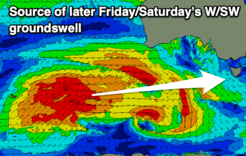
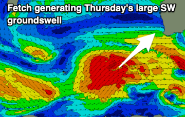
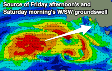
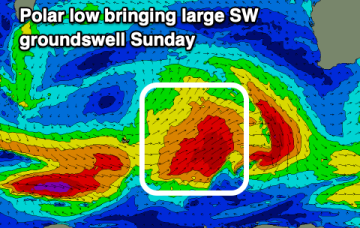
Large surf with better winds over the coming days before deteriorating from later Friday morning again.