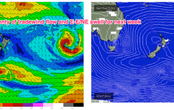
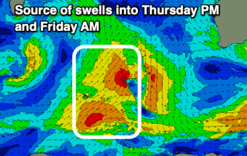
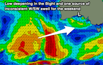
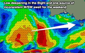
A much stronger high is moving into the classic La Niña slot- SE of Tasmania- where it will start to be squeezed by another approaching inland trough and complex low pressure system. That will see increasing E- NE winds come into play from mid-week with increasing levels of NE-E/NE windswell, especially on the Mid North Coast. Frontal progressions passing well to the south no longer have a strong surge into the Tasman but will send mid/long period pulses of S-SSE swell our way from mid week while a strong developing trade-wind flow will keep swell chugging away from the E into next week. A very active outlook for October.