Tricky winds with plenty of swell from the south
Monday, 14 November 2022
Tricky winds with plenty of swell from the south
Monday, 14 November 2022
Chunky waves over the coming days with tricky and generally poor winds.
Chunky waves over the coming days with tricky and generally poor winds.
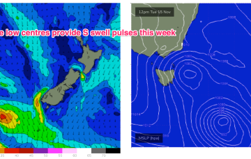
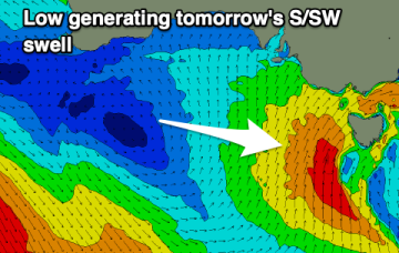
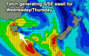
A warm front has bought a W’ly change to temperate NSW, extending southwards to Tasmania. Through the early part of this week the low slips SE of Tas and a complex, troughy pattern with multiple low centres sits in the Tasman. This complex low pressure area eventually gets squeezed by an oncoming high generating fresh S’lies and which overlap with deeper S’ly fetches to create a series of S swells this week.
A couple of clean mornings but small surf, onshore through the end of the week before improving slowly on the weekend.
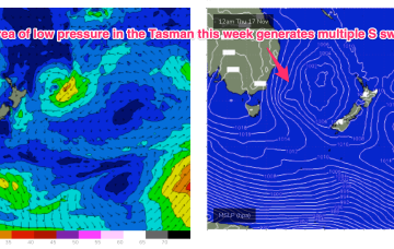
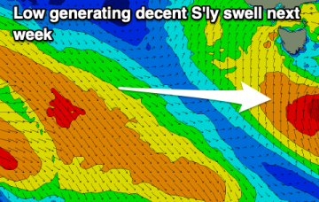
Through the early part of this week the low slips SE of Tas and a complex, troughy pattern with multiple low centres sits in the Tasman. This complex low pressure area eventually gets squeezed by an oncoming high generating fresh S’lies and which overlap with deeper S’ly fetches to create a series of S swells later this week.
Through the early part of this week the low slips SE of Tas and a complex, troughy pattern with multiple low centres sits in the Tasman. This complex low pressure area eventually gets squeezed by an oncoming high generating fresh S’lies and which overlap with deeper S’ly fetches to create a series of S swells later this week.
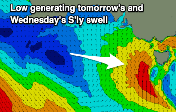
Winds will favour the gulf tomorrow with a drop in swell from today. The South Coast should become fun later week.
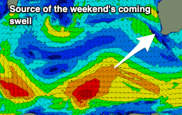
The surf will continue to build in size tomorrow but with generally poor conditions, only improving from Friday but best Saturday.
Troughs and southerly winds look to spoil a few fun swells this period. Try the East Coast.
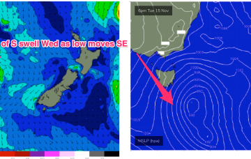
By Sunday an approaching cut-off low and high in the Tasman drive a straight onshore E to NE flow onto the East Coast.
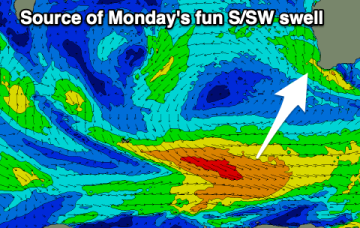
The surf looks a bit smaller with mid-period S/SW energy, clean and fun early next week.