Tricky swells to end off the week
Wednesday, 2 August 2023
Tricky swells to end off the week
Wednesday, 2 August 2023
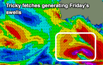
Today's swell will ease tomorrow ahead of a tricky mix of swells Friday along with tricky winds.
Today's swell will ease tomorrow ahead of a tricky mix of swells Friday along with tricky winds.
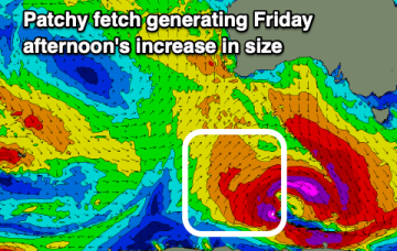
We've got an oversized groundswell on the build with winds favouring protected spots, cleaner and slowly improving as it eases into the end of the week.
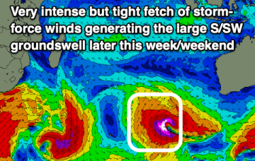
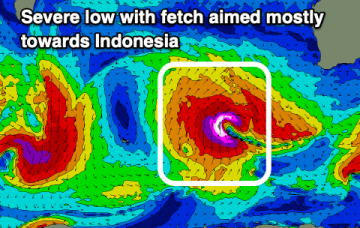
A massive high (1035 hPa) is currently moving over temperate NSW into the Tasman Sea, with a SE surge extending up the sub-tropical to tropical Eastern Seaboard, and a more N’ly flow south of Seal Rocks. In the wake of a strong front earlier this week we have still have moderate S swell trains propagating through the Tasman Sea which will be our main swell source through the short term.
The Mid Coast will see onshore winds arriving with the coming swells into the end of the week, cleaner down South.
Make the most of the current swell and conditions before things becoming tricky into the end of the week.
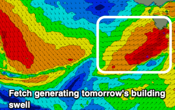
Good swell on the build later today with a larger but short-lived pulse for Friday/Saturday.
Lots of wind and plenty of swell but with west in in. There'll be options over the coming days.
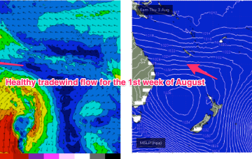
Once the dominant high enters the Tasman on Wed we’ll see a SE’ly to E'ly tradewind pattern start to establish through the Coral Sea, more typical of Summer, likely extending into the weekend with plenty of workable tradewind swell associated with it.
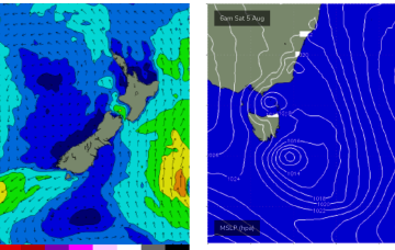
Large swell mid-week, improving as it eases with another strong swell for the weekend with windows of lighter winds.
Once the dominant high enters the Tasman on Wed we’ll see a N’ly pattern start to establish, more typical of Spring/Summer, with some workable NE windswell associated with it.