
Running Hot In The Eastern Pacific

Back in April, before the Pacific's hurricane season began, NOAA's Climate Prediction Center put their chips on the table.
While an average hurricane season typically sees eight hurricanes across the eastern Pacific basin, NOAA upped the ante forecasting between nine and eleven. In percentage terms they gave a 70% chance of above-normal activity.
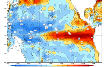
It was hardly a reckless bet by NOAA. With an El Niño event brewing in the equatorial Pacific, creating warmer than normal water and weak wind shear, the seeds were sewn for storm development.
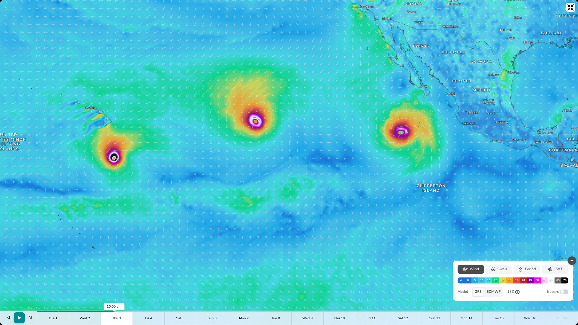
Later this week, it's possible that three concurrent hurricanes will be in the eastern Pacific (Swellnet/GFS)
So far the forecast has held up. An early run of tropical storms built into overlapping hurricanes with Fausto and Genevieve. The latter developing into a Category 5 hurricane.
Shortly afterwards, Hurricane Lala passed south of the Hawaiian islands, the associated rain causing flash flooding and setting new rainfall records on the Big Island.
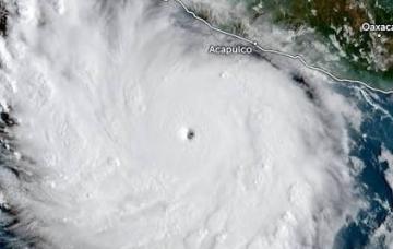
As the equatorial waters warm further the rate of activity is increasing. Last weekend, Hurricane Karina spun up from tropical storm to Category 4 in barely 48 hours. By Monday, Karina had winds of 230 km/h and sat roughly 1,500 km/h west-southwest of the tip of Baja California. Satellite imagery shows Karina's eyewall deteriorating. Forecasters expect a gradual weakening as it moves slowly west.
However, as is typical of the season, Karina isn't travelling alone. Tropical Storm Lowell has been churning well east of Hawaii since late last week. It's expected to become a hurricane, possibly by as early as tomorrow, before also moving west.
Of greatest interest is a third system, currently called Invest 95E and sitting south of Baja California. The reason it's been getting attention is because both major weather models have the system deepening into a hurricane - to be named Hurricane Marie - and following a track that curves towards the Southern Californian coastline.
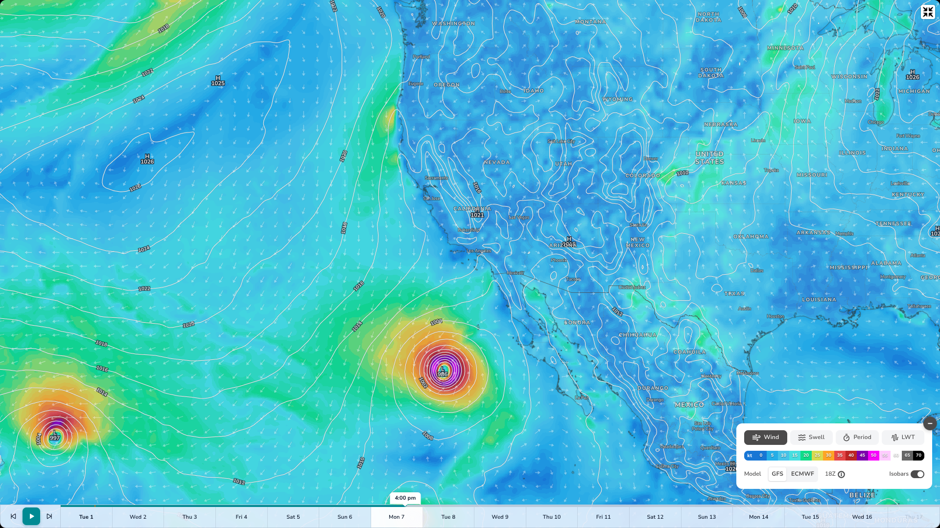
Though a long shot, if this GFS modelling were to transpire everywhere from Cabo San Lucas to Santa Cruz (and beyond) will get waves (Swellnet/GFS)
Ocean water off California itself remains too cool to sustain a tropical system regardless of the path, and the eastern Pacific generally turns hostile to storms north of about 30 degrees latitude. Still, the clickbait industrial complex is currently in overdrive.
A more sober analysis, one that takes into account historical paths, would have Marie staying well offshore or possibly veering west. Either outcome could be great for swell from Baja up to Northern California.
However, the bigger story is the pattern. Later this week the eastern Pacific may have three active hurricanes - proof that a season forecast to run hot is running hot.
Check out Swellnet's San Clemente surf forecast
Comments
Ensemble model showing the likeliest path of Invest 95E - the soon to be Hurricane Marie - is a westward curve offshore from Central Baja. If it happens, there are going to be great waves over a large swathe of the Cali coastline, particularly south of Point Conception.
It's going to be a long hurricane season out here on Kaua'i, especially once the steering flow starts coming from the south to south west. I bet we are going to be seeing anomalous hurricanes well into the winter.
The westerly winds around 5-15N along the Central Pacific are crazy and setting up a very active ITCZ and monsoonal troughs where you rarely ever see them form.
Latest update:
Hurricane Karina still a Cat 4.
Tropical Storm Lowell deepened into a hurricane.
Tropical Storm Marie has formed and is likely to become a hurricane tomorrow.
Three storms, two hurricanes, possibly three.
Pretty amazing satellite imagery..
Waaaait a minute....
Is this just an article to tell us there's now a San Clemente forecast?? ;-)
Marie just became a hurricane so there are three active hurricanes between the mainland Hawaii.
Any implications for Trestles Stu?
Not really. The swell from Marie is hitting tomorrow into Tuesday before the system heads west into the Pacific, after which Trestles will again rely on long range S swell. Unfortunately there's not much of that into the beginning of the waiting period - maybe a few feet of inconsistent swell.
We'll have a more detailed FC tomoz.
Epic!
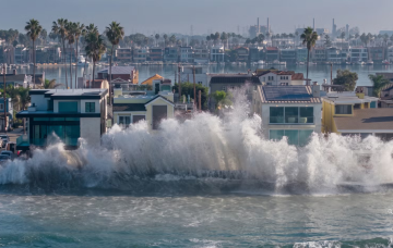
Looks like Hurricane Marie has also resulted in significant coastal erosion including below actor Nicholas Cage’s new house at Malibu. Crazy photo showing how close the houses are built to the beach with a wave breaking in the background.
https://www.thenewdaily.com.au/life/entertainment/celebrity/2026/09/09/…