Large clean easing swell this week

Western Australia Surf Forecast by Craig Brokensha (issued Monday 20th August)
Best Days: Wednesday, Thursday, Friday morning, early Saturday selected breaks
Recap
Pumping great waves across the state on Saturday with a clean moderate to large easing SW groundswell and offshore winds, small to tiny on Sunday but clean again through the morning.
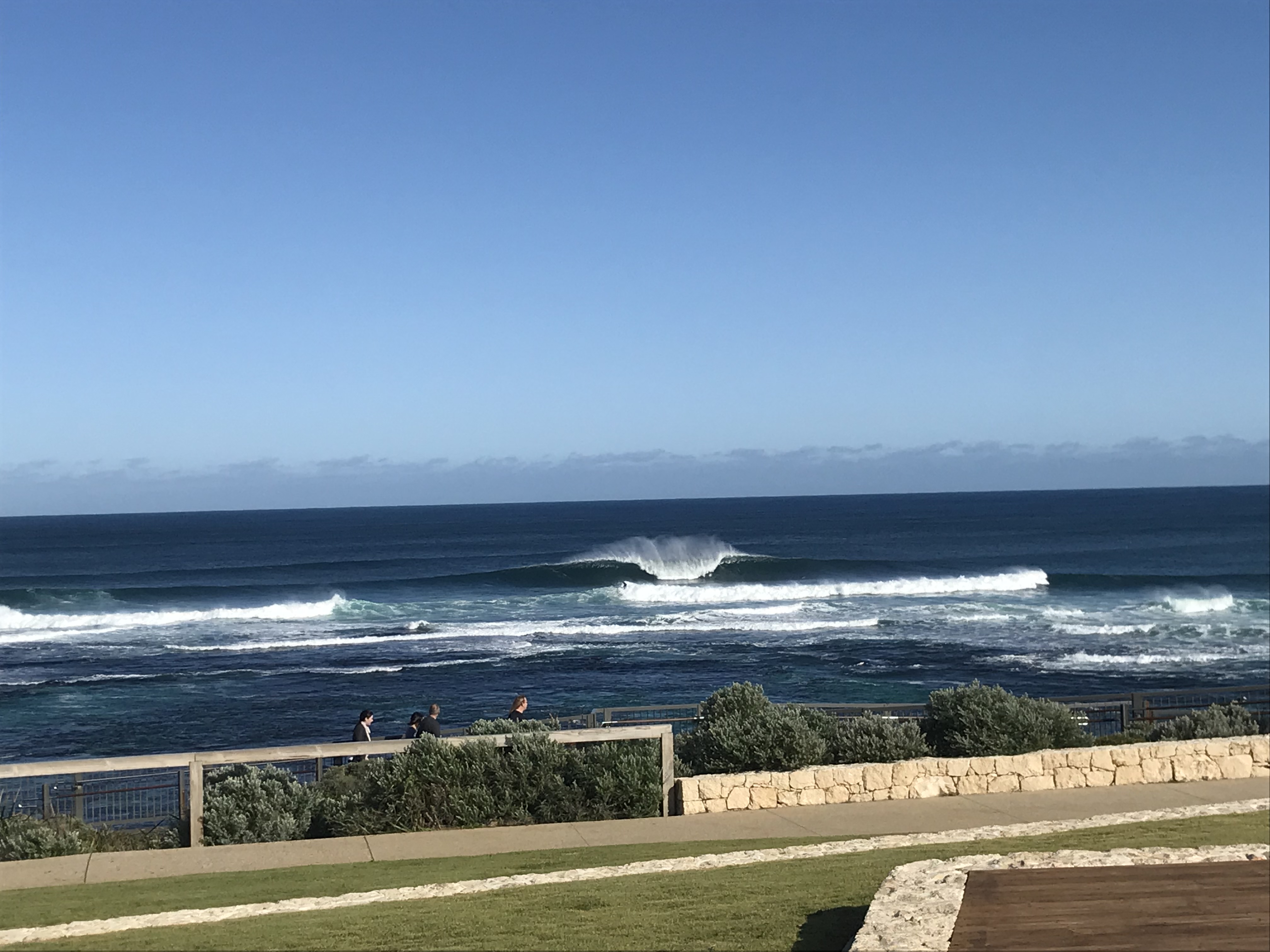
Today started slow but nice and clean across the South West and good at magnets, tiny to the north. A new pulse of swell has started to build and winds are more favourable than forecast on Friday with straight offshore breezes and sets reaching 4-5ft across the magnets.
Today’s Forecaster Notes are brought to you by Rip Curl
This week and weekend (Aug 21 - 26)
A small mid-latitude low that's currently to our west, resulting in today's offshore winds across the South West and onshore change in Perth and Mandurah, will move across us tomorrow and with this we'll see onshore W'ly tending SW winds across all locations.
Similar amounts of swell to this afternoon is due, but with those onshore winds, there'll be nowhere to recommend for a surf.
A slightly stronger W/SW groundswell is due to build later in the day and peak Wednesday morning ahead of the much larger and stronger long-period groundswell into the afternoon.
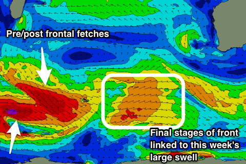 The large groundswell was produced over the weekend, with a vigorous and broad polar low forming west of Heard Island, generating a fetch of severe-gale to storm-force W/SW winds, moving slowly east before weakening east of Heard Island last night and into this morning.
A large long-period W/SW groundswell should be seen, building rapidly from about late morning across the South West and reaching 10ft+ on the sets by dark, with building sets to 3ft around Mandurah, 2ft+ in Perth.
The low/trough will move off to the east and with this we'll see winds improve and tend S/SE across the South West Wednesday morning, SE-E/SE across Perth and Mandurah, S/SW into the afternoon. The morning will be undersized though and likely 1-1.5ft in Mandurah and Perth with 4-5ft+ sets across the South West.
Thursday looks excellent with the groundswell easing back from 8-10ft in the South West, 2-3ft in Mandurah and 2ft+ across Perth with an E/NE offshore, tending variable into the afternoon.
Before the swell really gets to ease much further on Friday, a reinforcing SW groundswell is due off a storm forming in a similar region to the weekend's.
A broad and elongated pre-frontal fetch of W/NW gales will push east through our south-western swell window, with a post-frontal W/SW fetch.
This will produce two seperate pulses of SW groundswell, the first for Friday and the secondary for Saturday.
Size wise, the South West looks to come in around 6ft+ both Friday and Saturday with 2-3ft sets across Mandurah and smaller inconsistent 2ft sets in Perth. Winds will start to deteriorate though, coming in moderate to fresh from the NE early Friday, N/NE into the afternoon, while Saturday looks worse with N/NE tending NW winds.
These deteriorating winds will be linked to a weakening front come surface trough approaching from the west and with this we'll see no new swell but onshore winds into Sunday as the swell eases.
Longer term a vigorous polar frontal progression developing south-west of us is likely to generate a large S/SW groundswell mid-next week, but more on this Wednesday.