Poor weekend of waves, brief windows east of Melbourne next week

Victorian Surf Forecast by Ben Matson (issued Friday 23rd February)
Best Days: Tues PM/Wed: fun surf early of Melbourne with offshore winds and a dropping swell.
Recap: A small long range groundswell built through Thursday afternoon, peaking overnight before easing this morning. Set waves have been extremely inconsistent, and at the bottom end of the expected forecast range, reaching 3ft east of Melbourne and 1.5ft west of Melbourne. Variable winds and sea breezes on Thursday have swung light NE this morning, and will likely freshen from the north later as the swell continue to abate.
Today’s Forecaster Notes are brought to you by Rip Curl
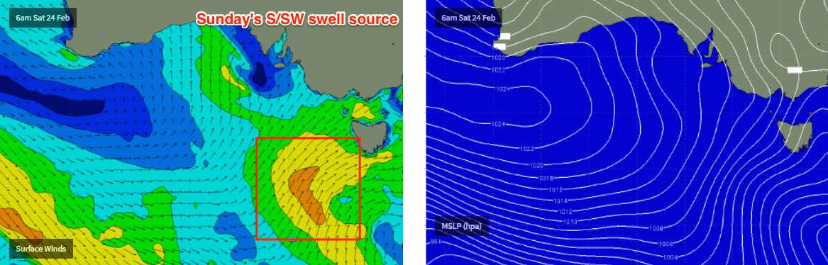
This weekend (Feb 24 - 25)
Poor surf is expected for much of this weekend, with a front crossing the coast expected to freshen NW winds ahead of a gusty SW change mid-late Saturday morning.
This’ll maintain bumpy conditions right across the coast, even into Sunday under a more direct (though easing) S’ly airstream. Chances for a brief window of light variable winds west of Melbourne early Sunday are remote.
Saturday’s swell prospects are small and insignificant anyway. The buoys may show some new long period energy (overnight tonight) but it will have been generated a very long distance from the mainland and will therefore be tiny at the coast in the morning. A minor increase in windswell may occur into the afternoon but conditions will be very ordinary.
Probably the only interesting feature is a small low embedded behind Saturday’s front that’ll generate a better S/SW swell for Sunday - though it’s a shame winds will be onshore. This should lift surf size from 2-3ft to 3-4ft across the Surf Coast, reaching 4-6ft east of Melbourne, though quality will remain poor.
Next week (Feb 26 onwards)
Sunday’s swell will ease rapidly through Monday, and winds will swing E’ly before veering NE into Tuesday. There won’t be enough size for anything worthwhile west of Melbourne (plus, local winds won’t be great either) so it looks like a lumpy round of solid surf east of Melbourne early Monday, improving during the day and then becoming clean albeit small through Tuesday.
A cold front will then approach from the west, delivering a gusty wind change early Wednesday and a couple of mid-range W/SW and SW swells will filter in behind for the following days, generated in the lee of the front plus some weekend storm activity well to the SW of WA (though not of any major size consequence). Wednesday looks to be a write-off due to the local winds but we should see small workable options west of Melbourne on Thursday and Friday with light variable winds and sea breezes.
Long term beyond this has nothing of any major interest on the synoptic charts. Hopefully Monday will have better news!
See you then.
Comments
Nice arvo lines at Woolamai.


for tomorrow the forecast says 2ft. but in the notes you've got 3 to 4ft?
Which one is it?
Which coast? Winds are gonna be onshore anyway..
Torquay region, and? People surf onshore most of summer, as it’s pretty much onshore/cross all summer here.
Model data has 2ft in the morning, building to 3-4ft in the arvo. Very close to what the notes above say.
Fair enough, there’ll be surfable options if you live locally, but my point was that I wouldn’t consider putting in any miles for surf tomorrow.
In not putting in any miles do you mean the 66 miles from Melbourne cbd to bells.