Strong S'ly swells Saturday; steady smaller swells for the rest of the period

Sydney, Hunter and Illawarra Surf Forecast by Ben Matson (issued Friday 20th January)
There's only one week left to sign up for the P-Pass competition! Sign up to Swellnet’s newsletter and receive the Sydney, Hunter and Illawarra Forecaster Notes and latest news sent directly to your inbox. Upon signup you'll also enter the draw to win a surf trip to P-Pass for you and a mate. It doesn’t get much easier so click HERE to sign up now.
Best Days:
Recap: A decent southerly swell built across Southern NSW on Thursday with sets around the 4ft mark, and winds remained mainly light onshore so conditions were quite workable. Today we’ve seen smaller, easing S’ly swell from 3ft at south facing beaches, and freshening N/NE winds that have recently backed off and gone light and variable; winds actually went light NW across the Hunter for a few hours around the middle of the day too. These local N/NE winds have generated a building NE windswell that’s now providing 2-3ft sets at NE swell magnets across the Sydney region. The barometer is dropping steadily as a new low forms east of Tasmania; Montague Island in particular bottomed out at 988.8hPa around 2:30pm, which is almost 25hPa less than the same time yesterday (1013.5hPa at 2:30pm Thurs).
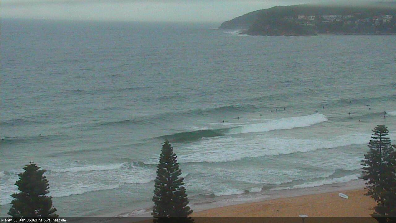
Fun NE swell at Manly this afternoon
This weekend (Jan 21st - 22nd)
A deep low is forming off Tasmanian’s East Coast, and winds are expected to become pretty strong off the Far South Coast tonight. The low will project NE into the Tasman Sea, and although the fetch around its western flank will be only short, it will become “captured” which exacerbates the potential size - even if for a brief period of time. The models have increased core wind speeds too (since Wednesday's forecast) as the low develops this evening.
These factors have slightly increased size prospects for south facing beaches on Saturday, though the accompanying southerly winds will render most locations quite bumpy. A handful of locations should see an early period of SW winds though this will probably be limited to the Northern Beaches and some parts of the South Coast.
Maximum surf size is expected through a period during the middle of the day; from late morning through early afternoon (so, early morning may be a little undersized). South facing beaches are likely to reach 6ft+ at times, and it’ll be smaller at remaining open beaches with 3-5ft sets (smaller again inside southern corners, around 2ft+).
The Hunter usually picks up more size from these kinds of systems but with the local winds you’ll really have to look towards a sheltered location.
On Sunday, we’ll see greatly improved conditions as winds become light and variable ahead of a moderate afternoon sea breeze.
Saturday’s south swell will be steadily easing (early 3ft+ sets south facing beaches, smaller elsewhere but bigger in the Hunter), however we’re also looking at the arrival of a secondary S/SE groundswell throughout the day. This will have originated from the distant polar fetch that contributed a small pulse of S/SE swell on Thursday. No great size is expected from this source, but it’ll nicely arrest the otherwise easing pre-existing S’ly swell, keeping south facing beaches in the 2-3ft range throughout the day. Expect long breaks between the sets, especially into the afternoon as the long range S/SE swell becomes the dominant energy.
Just a small point on the model data for Sunday - I think it’s overcalling predicted size, because it’s combining the two swell trains mentioned above. Because the (current) developing low moves rapidly through our swell window overnight tonight, I’m expecting Saturday’s pulse of strong S’ly swell to be a brief affair. However despite estimating 6ft sets through Saturday afternoon (I think it'll go a smidge higher), it eases only to 3-5ft by Sunday morning. Interestingly, there is also only one swell train in the water on Sunday morning.
But if you observe the modeled swell direction, you’ll notice something unusual: at 6am Saturday it’s at 187 degrees, by 6pm it’s already at 178 degrees. But then by 6am Sunday the direction has gone further east to 170 degrees, and by 6pm it’s at 160 degrees.
Single swell events don’t swing 27 degrees in thirty six hours (or, 18 degrees in 24 hours). What’s happening here is that the model is not resolving the individual swell trains well - because they’re of a similar direction and period - and therefore combining the energy into one, which is therefore overestimating potential surf size.
Hence why I think that set waves on Sunday morning will be closer to 3ft than the modelled 3-5ft.
Next week (Mon 23rd onwards)
The long range S/SE swell expected Sunday should continue through Monday, with inconsistent 2-3ft sets at open beaches with good southerly exposure. Early light N/NW winds will freshen from the NE during the day so aim for a morning surf for the best conditions. Otherwise hunt down a protected northern corner. Expect long breaks between sets.
These NE winds will generate some late peaky NE windswell for open beaches that should hold into Tuesday. Set waves should push the 2-3ft mark, though at the same time the long range S/SE swell will ease back in size, with a minor undercurrent of inconsistent 1-2ft surf. Tuesday's conditions are tricky to have confidence in right now, as an approaching southerly change will bring about a period of light winds through the morning or lunchtime period. Let’s firm up the details on Monday.
A late S’ly change on Tuesday afternoon will display a reasonable trailing fetch that should kick up some average short range energy for Wednesday; a likely size is 3-4ft at south facing beaches (smaller elsewhere) though conditions don’t look terribly flash with mainly S thru’ SE winds.
The long range S/SE fetch mentioned earlier is expected to strength over the weekend, and will generate one final groundswell that’s expected around Thursday - again, set waves will be very inconsistent but we should see occasional 2-3ft sets at open beaches. Current indications are for mainly light onshore winds.
Other than that, there are no other major swell generating systems expected for the long term period. Interestingly, the models maintain a lot of strong polar activity in our recent S/SE swell window, so we could be looking at a steady supply of small intermittent long period swell for the coming weeks.
Additionally, there are signs that the top end will become quite active with tropical cyclones through the coming weeks, which also opens up possibilities for our NE and E swell windows in early February.
More on this on Monday, have a great weekend !
Comments
Bloody hell, there's some size for ya!
Yes way. Buoys reading over 3.5m with 7.0m recorded max.....shame about the winds
Sydney Ports buoy (off Botany Bay) had an initial peak at 4:50am, with Hsig 3.99m and Hmax of 7.02m.
Also, note the recorded direction as well - 157 degrees, which is S/SE. This is because the buoy is close to shore - just 2.5km - which means that the open ocean S (or even S/SW) swell has already undergone some degree of refraction. The MHL buoy is around 10km offshore (from Dee Why) and therefore suffers less from this.
Baby woke me up @5am and I looked at this, the early was fun. Dropped quick though.
Ben the budgie smugglers have the row boats out today should be good viewing........bit of carnage I think
Nice section at the Island this morning.
Looks like I was unnecessarily pessimistic about today's size in Sydney. Although I still think the automated 3-5ft call was a little high, set waves are a solid 4ft at Bondi, which is bigger than the 3ft+ I was expecting. Looks pretty strong too.
The surf is solid in the Illawarra today 4-5 ft no worries
NB reefs saw a few solid 4ft occasionally roll in