Saturday the pick of the forecast period

South-east Queensland and Northern NSW Surf Forecast by Ben Matson (issued Friday 16th March)
Best Days: Sat: fun waves across most open coasts in the morning. Sun: small beachies in SE Qld and Far Northern NSW (banks permitting). Next Wed onwards: plenty of swell but dicey winds.
Recap: Thursday delivered a strong combo of swells out of the eastern quadrant, generated mainly by ex-TC Linda. Wave heights across most regions were close to expectations (5-6ft open coasts, smaller down the points) however the Gold, Tweed and Byron Coasts saw an early period of larger sets north of 6ft and close to 8ft at times (bugger! should have held in with Monday’s estimates). Winds were out of the S thru’ SE so protected spots were best, and size eased a little into the afternoon. We’ve seen a much more pronounced drop in size today, and conditions have again been best suited to the protected points.
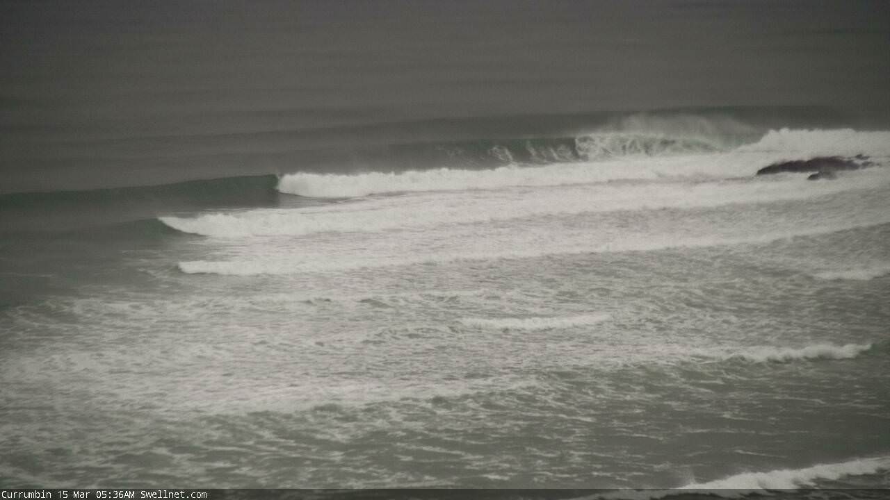
Early Thursday morning at Currumbin
Today’s Forecaster Notes are brought to you by Rip Curl
This weekend (May 17 - 18)
Our swell combo originating from ex-TC Linda will continue to fall away steadily into the weekend, however there’s new energy inbound from two sources.
The remnants of ex-TC Linda are lingering well off the SE Qld/Far Northern NSW coast in the form of a weak, poorly aligned trough. However it’s relatively stationary and should maintain small peaky surf through the weekend, biggest at exposed northern ends (and preferencing the Sunshine Coast) with 2-3ft sets. Expect smaller surf elsewhere (i.e. marginal size, and very inconsistent across sheltered points) with easing wave heights from this source as you track south from the Gold Coast. This weaker swell won't like the large high tides very much either.
Winds should be OK early morning (light to moderate S/SW) but expect it to swing S’ly then SE throughout the day. Light variable winds and sea breezes are expected on Sunday with a smidge less size.
South of Byron, we’ll see small E’ly energy from this source but of more interest is a new long period south swell that’ll build throughout Saturday.
It’s yet to show across Far Southern NSW (which is of slight concern, though it’s only a few hours late so far, and Victoria/Tasmania have seen some strong waves today form the same system, as expected) but we should see it build across the Mid North Coast mid-late morning, reaching a peak mid-late afternoon here, arriving much later across the Far North Coast. Set waves should manage 3-4ft+ at south swell magnets south of Byron into the afternoon but there won’t be much happening elsewhere due to the acute direction. Expect long breaks between the sets too.. this swell has originated a long way from our region.
Saturday’s winds look good in Northern NSW, early light NW south from Yamba (variable elsewhere) tending N’ly then NE into the afternoon. Sunday’s looking a little less favourable, with freshening northerlies through the morning tending gusty N/NE into the afternoon, but Saturday’s south swell will be rapidly on the way out so only the early session will have any value, and only at exposed northern ends/sheltered south swell magnets.
Next week (May 19 onwards)
The first few days of next week don’t look too flash right now.
Northerly winds will continue about the Mid North Coast, with lighter E/NE winds across the Far North and SE Qld coasts, and the weekend’s swells will bottom out, with just a small secondary pulse of south swell for Northern NSW’s south swell magnets on Monday, exclusively south of Byron. Expect small residual surf throughout SE Qld.
A small new E’ly swell generated by a weekend fetch off the top of New Zealand’s North Island won’t arrive until later Tuesday, and show properly through Wednesday. It’ll be supplemented over the following days by a bigger fetch from a broader ridge further east (from the original source) but no major size is expected from this system until the weekend or later, and whatever swell makes landfall prior to then - perhaps some 2-3ft+ sets - will be overshadowed by a stronger local system.
This local system will originate as a southerly change across Southern NSW into Tuesday, broadening across the Northern NSW and SE Qld coasts from Wednesday onwards as a large high across the southern states strengthens a ridge across the western Tasman Sea. In fact, this looks like it’ll maintain some form of fresh south-east tending easterly wind about most regions from Wednesday through the weekend.
Sure, we’ll see plenty of size by the end of the week (and into next weekend) but even with 4-6ft surf across open beaches, there’s only a small percentage of locations that will offer shelter from these conditions.
As such, expect a mixed bag of mediocrity for the long term. It’s great to see such an active synoptic chart but I’m doubtful for any great quality for a while.
Looking beyond this, and a developing low atop the large high north-east of New Zealand (mid-next week) should generate a longer period east swell for the start of the following week. Also, we have plenty of additional activity likely in the Tasman Sea but I’ll look more into this in Monday’s notes.
Have a great weekend!
Comments
Hey Ben, generally your forecasts are bang on and I've had plenty of success from reading into them. This weekend though, a couple of other sources have local (sunshine through gold coasts) winds trending SSE through ESE while your notes say more northerly is likely. Any insight as to why the different outlooks?
Thanks mate. Re: winds - that's for Northern NSW. A couple of paragraphs above, I wrote for SE Qld: "Winds should be OK early morning (light to moderate S/SW) but expect it to swing S’ly then SE throughout the day. Light variable winds and sea breezes are expected on Sunday with a smidge less size. "
For Northern NSW, I wrote: "Saturday’s winds look good in Northern NSW, early light NW south from Yamba (variable elsewhere) tending N’ly then NE into the afternoon. Sunday’s looking a little less favourable, with freshening northerlies through the morning tending gusty N/NE into the afternoon".
Looks like the new S'ly swell is starting to show in Coffs. Sydney buoys picked up Tp of 17 seconds overnight so it should show very nicely at reliable south swell magnets throughout the day.

Yesterday's south swell is easing across the coast, but still showing nicely at Coffs.