Waves, waves, waves. Who woulda thunk it?

South-east Queensland and Northern NSW Surf Forecast by Ben Matson (issued Friday 24th February)
Best Days: Fun surf most days across the SE Qld and Northern NSW points under a general S'ly tending SE airstream. Sat AM for the most size initially, then slowly building trade swells from Mon afternoon onwards as a long lived ridge builds across the Northern Tasman Sea. Could become sizeable next weekend too (though more likely down south than up north).
Recap: A peaky short range E’ly swell offered fun surf across SE Qld and Northern NSW on Thursday around 2-3ft at open beaches. Today we’ve seen this short range swell ease back, and largely replaced with a long period E’ly groundswell generated way out in the South Pacific Ocean earlier this week. Set waves are extremely inconsistent but pushing 3ft+ at exposed locations, and may become a little bigger this afternoon. Winds are mainly S’ly tending SE, so the points have the best options.
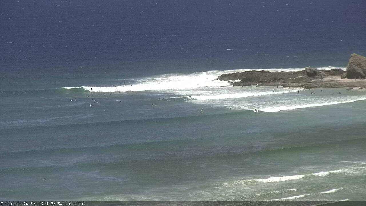
Lunchtime sets at Currumbin from our new surfcam
This weekend (Feb 25th - 26th)
It's difficult to assess the precise trend of upcoming groundswells generated large distances from the coast. That is, exactly when we’ll see a peak in size across the region. A lack of physical buoys in our eastern swell window compounds the issue, which is much different to southerly swells (which we can track along the Southern NSW coast).
As such, it’s hard to know whether our new easterly groundswell will reach a peak this afternoon, this evening, or sometime on Saturday.
Model guidance seems to be suggesting a peak on Saturday thought’s having a hard time splitting the individual swell trains apart. For example, our Gold Coast data point at 12pm today has the dominant swell of 1.4m @ 8.2 seconds out of the E/SE, plus the new long range groundswell of 0.9m at 12.1 seconds from the E/SE and a small S’ly groundswell of 0.6m at 12.1 seconds.
But 6am Saturday morning? These three swell trains have been consolidated into one E/SE swell of 1.5m at 11.4 seconds. And this is resulting in a “peak” in surf height according to the models. But I think that is erroneous.
So whilst tomorrow looks the most promising for size (compared to today) on paper, it could be a false reading. As such I am expecting an overnight peak and a slow easing trend during Saturday. The model has slightly undercalled today’s long range E’ly groundswell so we’re probably looking at 3ft to maybe 3-4ft sets early morning across exposed beaches in SE Qld and Far Northern NSW, but there’ll be extremely long waits between the bigger waves - you’ll mainly be surfing smaller 1.5-2ft leftover trade swell.
This E’ly swell will ease throughout the day too, and further into Sunday, with extremely inconsistent 2-3ft sets at exposed beaches in the north.
And as mentioned over the previous Forecaster Notes this week, there is a slight rise in swell periods modeled for Saturday, but these will be sourced from a much more distant fetch at the tail end of the system responsible for the current swell. As such I think the benefit of the larger wavelengths will be cancelled out by the extra travel distance. Thus, no major size increase.
Surf size will be smaller from this source south of somewhere on the Northern NSW coast, probably south of about Ballina or Yamba - owing to the swell shadowing of New Zealand’s North Island (where the source fetch was mainly tucked in behind).
A small increase in short range SE swell expected across Northern NSW later Saturday and into Sunday has been delayed and downgraded, due to the models repositioning the trough off Southern NSW. As such we should see a small increase in SE swell across the Mid North Coast on Sunday but no major size is expected from it, maybe some 2-3ft sets at exposed beaches.
As for winds, a general southerly flow is expected in all regions this weekend, mainly SW early and S/SE tending SE throughout the day - though no major strength so there should be fun waves at many locations.
Next week (Feb 27th onwards)
We’ve got some super fun waves on the way for next week.
A broad coastal trough is expected to redevelop across Southern NSW on Monday, and we’ll see a small undercurrent of leftover swell from the weekend across open beaches in most regions.
At the same time, a blocking synoptic pattern is expected to set up in our eastern swell window, comprising the coastal trough in NSW and a high pressure system in the south-eastern Tasman Sea.
A broad, stationary ridge is expected to develop to the north - across the greater Tasman Sea and South Western Pacific Ocean - and although surface winds aren’t expected to reach very high strengths, the sheer size and coverage of this fetch should allow for a fun, looking lined E/NE swell from Monday afternoon through next weekend and beyond into the following week.
The fetch will encompass most of the region but the primary engine room will be north of New Zealand, and it’ll take a little time to get moving. So, surf size and strength through the first half of the week may be a little undercooked. But open beaches should see plenty of surf in and around the 2-3ft mark, up to 4ft across reliable swell magnets as the energy ebbs and flows.
And, with some luck the coastal trough will keep local wind speeds at bay - we will see periods of onshores but they won’t be overly strong, so in general it’s looking OK for the points.
I’m also keeping my eye on a possible modelled E’ly dip forming in the Central Tasman mid-late week that could very well provide a much bigger boost to the East Coast later next weekend or early in the following week. These kinds of synoptic setups usually favour southern NSW with the most size but we certainly have the potential for a more significant increase in surf size across northern coasts too.
I’m really liking the way the models are evolving this under the blocking pattern so right now it’d be well worth your while getting some fitness training in as we could be looking at an extended run of punchy surf for the longer term period.
More on this in Monday’s update!
Comments
Nice. Just need some offshore mornings now to spread the hordes.
SW wind = crazy crowds throthing over rubbish waves
NW WIND = surfing open beaches no crowds having a bank to your self
I know what I'd rather
With ya there, umunga. Light west and everywhere pumps but.
but what?