Extended small trade swell for SE Qld, fun weekend south swell in Northern NSW

South-east Queensland and Northern NSW Surf Forecast by Ben Matson (issued Friday 9th December)
Sign up to Swellnet’s newsletter and receive the South-east Queensland and Northern NSW Forecaster Notes and latest news sent directly to your inbox. Upon signup you'll also enter the draw to win a surf trip to P-Pass for you and a mate. It doesn’t get much easier so click HERE to sign up now.
Best Days: Entire period from late Sat onwards: small trade swell across SE Qld - yeah it'll be lumpy and bumpy but it'll still be better than anything else you've seen of late. Sat/Sun/Mon: strong S'ly swell in Northern NSW
Recap: There ain’t been much surf across our region over the last few days. however a new S’ly swell is pulsing nicely through Southern NSW this afternoon and should reach the Lower Mid North Coast later today.
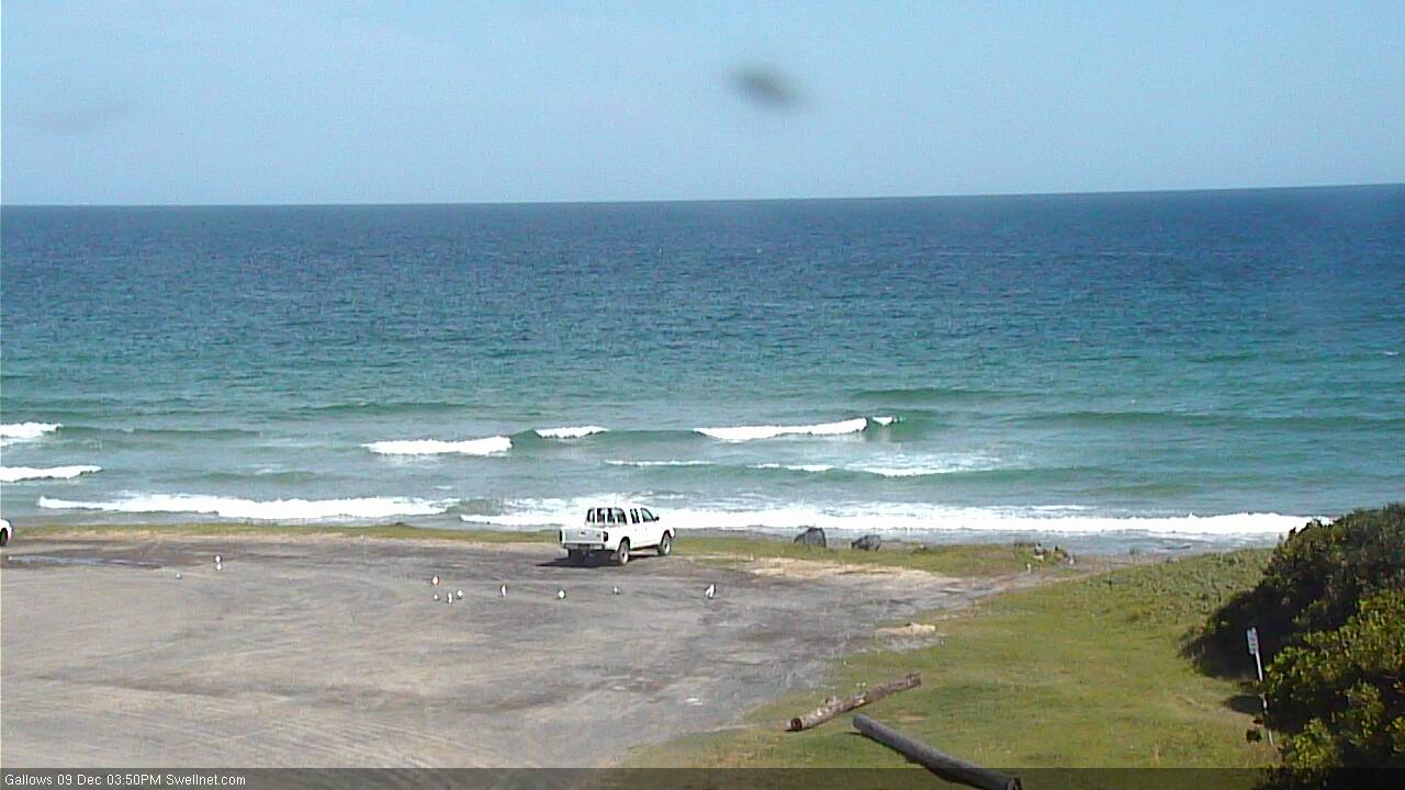
No sign of the new S'ly swell at Coffs around 4pm
This weekend (Dec 10th - 11th)
So, we’ve got a couple of swells for the weekend.
First up - SE Qld. A building ridge through the Coral Sea will slowly increase short range SE energy through Saturday and into Sunday, with the biggest waves being across the Sunshine Coast due to its closer proximity to the source fetch.
Wave heights should manage 2-3ft+ here at open beaches as the swell reaches a peak (late Sat thru’ Sun); they’ll be a little bumpy with moderate to fresh E/SE winds but protected points will be much smaller.
Surf size will be marginally smaller across the open Gold and Tweed Coast beaches, with 2ft+ sets at open beaches and slightly smaller waves running down the points (again, with smaller surf early Saturday morning ahead of a peak late Sat and thru’ Sun). We should see an early period of light SW winds across the southern Gold Coast, otherwise expect moderate to fresh SE to E/SE winds.
Surf size from this source will decrease with increasing southerly latitude, but the good news for Northern NSW surfers is that we have a strong S’ly groundswell making its way up the coast.
It’ll arrive in a couple of stages; it’s hard to be confident in exactly when the biggest waves will arrive but all signs are pointing to Sunday morning for the best surf.
Surf size should fluctuate in the 3-5ft range at south facing beaches (south of Byron) through Saturday, with a slightly stronger pulse due late Saturday (Mid North Coast) and throughout Sunday (Far North Coast) that could push 4-5ft+ at these swell magnets.
Surf size will be smaller at beaches not open to the south, but fortunately we’re looking at light variable winds and sea breezes in most regions both days. The Far North Coast (north from Ballina) may pick up the fringes of the local SE trade flow but even if this eventuates a brief early SW breeze is likely anyway.
South swell magnets in SE Qld will pick up some S’ly swell but to be honest I don’t think it’ll be that much bigger than the pre-existing trade swell (maybe a shade bigger on the Gold Coast). Though those beaches picking up the size will be slightly weird affected anyway.
All in all, it’s hardly an epic weekend but I’d certainly prefer this than the northerly mess we’ve been dished up of late!
Next week (Dec 12th onwards)
Along with a firm, stationary ridge through the Coral Sea, we have some other interesting developments in our Queensland swell window for the forecast period.
A broad, slow moving tropical depression centered north of Vanuatu is expected to intensify slowly all week. Model guidance doesn’t suggest it’ll drop into our swell window, however at the same time, it’ll anchor a broad trade fetch just through its northern periphery.
This should keep the SE Qld and Far Northern NSW region ticking over with small trade swell all week. No major size is expected, but we’re looking at size in and around the 2-3ft mark at outer points and exposed beaches, with a few embedded periods of marginally bigger waves. Winds should be moderate SE all week, with periods of early light SW’ers (less chance on the Sunny Coast until Tues or Wed when the ridge starts to weaken near the mainland).
Otherwise, our south swell window is initially looking a little quiet.
Sunday’s strong south swell will ease rapidly through Monday, with early 3-4ft+ sets at south swell magnets out of Byron (smaller elsewhere) easing during the day. Much smaller surf is expected through Tues and Wed thanks to an absence of major storm activity across the Southern Ocean.
Winds will also freshen from the north all week, which will create some problems on the surface here. There’ll be a region with lighter, more variable tending moderate E’ly winds (Far North Coast) whilst the northerlies will be strongest across the Mid North Coast. These winds will whip up some low quality windswell from late Wednesday through Thursday and maybe Friday but it’s not worth working around.
Otherwise, during the middle of the week, the models are suggesting a deep Southern Ocean low will move under Tasmania, setting up a solid, long period S’ly swell for the end of the week. It’s way too early to get excited but there are suggestions that Friday could see some strong building S’ly swell up to 3-5ft at south facing beaches south of Byron, holding into Saturday.
I’ll also be keeping an eye on a local trough around the Southern NSW region on Thursday that has the potential to develop into a more significant swell generating system.
Anyway, let’s wait and see how Monday’s model runs hold out.
‘Till then have a great weekend!
Comments
whoo boy oh boy oh boy, is Santa coming early?
Geez, I hope so. I hope some of that good stuff filters as far south as Sydney
Wow, long range Access G looking the goods in the SPCZ.....unfortunately GFS not really interested and EC having a bet each way between Access G and GFS. Still, very nice to see this early in the season. C'mon Access G!!!!
Hi Don
Where abouts do you view this model? Do you think you could post a link?
Access G
http://www.weatherzone.com.au/models/?lt=wzcountry&lc=aus&mt=accessg
GFS
http://www.weatherzone.com.au/models/?lt=wzcountry&lc=aus&mt=gfs
EC
http://www.ecmwf.int/en/forecasts/charts/medium/mean-sea-level-pressure-...
Certainly some good signs of tropical activity showing in all three charts across the top end of the continent and out into the SPCZ. Good to see this early in the season.
Still tagging lots of pointers in this forecast area ....it will never end !
NSWDPI shark team advise 2.59m female White Shark tagged and released off Evans Head Main Beach using SMART Drumline technology. Shark #73
NSWDPI shark team advise 2.37m White Shark tagged and released off Main Beach, Evans Head using SMART Drumline technology. Shark #72
NSWDPI shark team advise 3m White Shark tagged and released off Lennox Head Beach using SMART Drumline technology. Shark #71
NSWDPI shark team advise 3.2m White Shark tagged and released off Sharpes Beach, Ballina. Shark #70
NSWDPI shark team advises 2.72m White Shark tagged and released off South Ballina using SMART Drumline technology. Shark #69
Plus another ten foot white pulled out of the new nets at Sharpes and released alive.
Thats 6 in one day. Exercise extreme caution around here at the moment, there are very high concentrations of white sharks present in the inshore surf zone.
Just in time for school holidays ....
So i wonder if its like this else where where there are no drum lines and no fly overs......rare my arse.
3.5m white at Pass this morning.
Fun head high beach break peaks this morning, wind stayed light with glass at times until 11am. South swell combined with the easterly swell made for some fun wedges with ramps on the end, thanks for recommendations Ben
Didn't see anything all weekend near the upper end of the forecast even at magnets but some fun little sliders all the same...
My mate was the guy last Thursday that got attacked by a 4.5m great white @ Bulls paddock just south of Forster! I was out before him that morning but not in the water @ the time of attack. He has spoken to me @ length about the attack, dolphins were in a pod under his board just before he got lifted into the air in a classic great white initial attack. He was about 100m off the beach in shallow water! Checked Bulls on Sat morning with this south swell not quite lining up @ 4to 5ft on the sets! No one in the lineup when I checked it about 9am. I surfed both days but not @ Bulls! My friends survival is miraculous with several factors working to his advantage, he has 32 stitches in his heel which he kicked the shark with in the nose, head & mouth. His recovery will take several months,one very lucky surfer to survive this attack considering the shark tried 3 times to take him!!! Take care fellow surfers!
I'm guessing the shark probably thought your mate was a dolphin that strayed from the pod.....lucky boy.
What about beaches like treach and sandbar, have the crowds thinned cause of the shark? Considering they're relatively isolated up your way
There have been lots of sightings @ both locations! However when the surf is on the pump it is still crowded on the w/ends!