Easing S swell over the weekend, N/NE windswell next week

Eastern Tasmania Surf Forecast by Craig Brokensha (issued Friday 10th November)
Best Days: Saturday morning south magnets, later Wednesday open beaches
Recap
Average small onshore waves yesterday, while today, our new pulse of S'ly groundswell has come in at a good 3ft+ across the coast with a light morning offshore wind.
This weekend and next week (Nov 11 - 17)
Todays pulse of S'ly groundswell should have started to drop into this afternoon, with it expected to drop further through the weekend, from 2ft to maybe 3ft at south swell magnets, tiny Sunday.
 Conditions will be clean tomorrow morning with a light offshore wind, giving into afternoon sea breezes, so get in early.
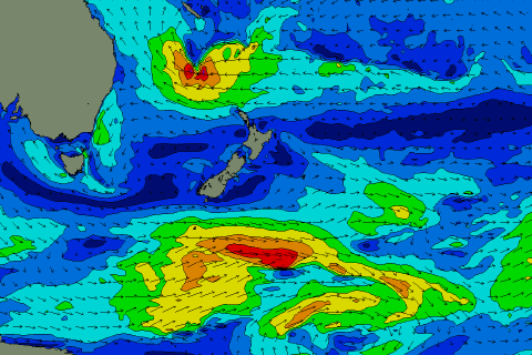
As touched on in Wednesday's update, we'll see a strong high pressure ridge moving very slowly though the Tasman Sea, with an approaching trough from the west resulting in strengthening N/NE winds down our coast from Monday evening, retracting temporarily Wednesday evening as the trough moves across us before likely developing later in the week again.
This will generate small to moderate amounts of N/NE windswell, building to 2-3ft late Tuesday, holding 3ft Wednesday and then easing once that change moves through. Winds look average until the late change on Wednesday, while we'll see onshore S/SE winds Thursday with some small S/SE windswell.
The other source of swell, that being a deepening tropical low on the northern flank of the high is still on the cards (pictured above), though the timing of this has been pushed back to next weekend/the following week. More on this Monday, have a great weekend!