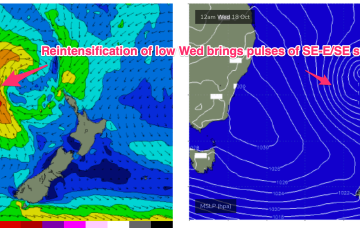
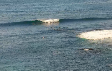
A strong front and embedded trough of low pressure are currently located just off the Gippsland Coast, expected too move NE into the Tasman and driving a strong/ near gale force S’ly flow up the NSW Coast today, reaching the QLD in the wee hours of Tuesday. There’ll be an initial burst of S swell associated with the proximate fetch, with some better quality SE-E/SE swell from a secondary intensification of the low as it becomes slow moving near New Zealand.
Primary tabs
/reports/forecaster-notes/sydney-hunter-illawarra/2023/10/16/plenty-s-swell-short-term-cleaner-better
freeride76
Monday, 16 October 2023
/reports/forecaster-notes/sydney-hunter-illawarra/2023/10/13/plenty-s-swell-over-the-weekend-windy
freeride76
Friday, 13 October 2023
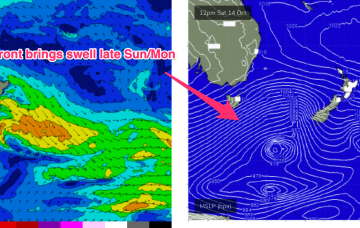
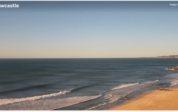
We’ve got more clarity on the situation next week now as a lingering trough line from the NSW South Coast down to Gippsland is expected to deepen in response to a front and form a surface low in the Tasman Sea, likely later Mon.
/reports/forecaster-notes/sydney-hunter-illawarra/2023/10/11/more-swells-the-s-some-potential-next
freeride76
Wednesday, 11 October 2023
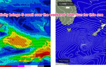
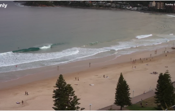
Moderate strength high pressure (1025 hPa) is drifting NE into the Tasman with a strong polar storm well SW of NZ exiting the swell window. That should see a settled short term before another complex trough and frontal system pushes north along the coast tomorrow with a stiff SW-S change. More rapid wind changes into and over the weekend under a very mobile, troughy pattern with some potential next week for a surface low to form in one of the trough lines.
/reports/forecaster-notes/sydney-hunter-illawarra/2023/10/09/coupla-south-swells-week-mixed
thermalben
Monday, 9 October 2023
The early arrival of today’s south swell means the short term schedule has been brought forward
/reports/forecaster-notes/sydney-hunter-illawarra/2023/10/06/plenty-south-swell-just-gotta-pick-the
thermalben
Friday, 6 October 2023
A series of secondary southerly swells will fill in overnight, replacing today's energy and maintaining...
/reports/forecaster-notes/sydney-hunter-illawarra/2023/10/04/great-waves-thursday-then-mixed-round
thermalben
Wednesday, 4 October 2023
Today's building short range NE swell will reach a peak during the middle of the night.
/reports/forecaster-notes/sydney-hunter-illawarra/2023/10/02/large-ne-swell-mid-week-looking-best
thermalben
Monday, 2 October 2023
Main feature on the synoptic charts is a strengthening N'ly fetch adjacent the NSW coast, between a Tasman high and an approaching front through the Bight.
/reports/forecaster-notes/sydney-hunter-illawarra/2023/09/29/workable-options-over-the-weekend
freeride76
Friday, 29 September 2023
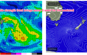
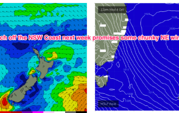
We’ve got a strong, expansive front passing through the Tasman at present will which supply pulses of S swell over the coming days. High pressure over NSW is moving NE into the Tasman, with a N’ly flow developing. That N'ly flow will really intensify next week with some juicy NE windswell resulting.
/reports/forecaster-notes/sydney-hunter-illawarra/2023/09/27/modest-mixed-bag-continues-the-weekend
freeride76
Wednesday, 27 September 2023
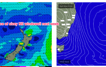
High cells are now tending to move NE as they enter the Tasman, bringing N’ly episodes which were rare through our triple La Niña but are becoming common as we enter El Niño proper. Small, combination swells and some light wind periods pad out the rest of the week with a more entrenched N’ly episode next week offering potential for a much juicier NE swell.
/reports/forecaster-notes/sydney-hunter-illawarra/2023/09/25/lots-wind-changes-and-small-swells-work
freeride76
Monday, 25 September 2023
The high pressure belt is behaving in typical spring fashion- tracking NE as it enters the Tasman with episodic N’lies. We’ve got a small fetch out of Cook Strait at present from a decaying low pressure system, and small, compact low about to enter the Tasman. Combined with some swell from a tradewind band feeding into a long trough we’ll see concurrent small swells from these sources.